


Plains Voting District, Rockingham County, Virginia
About
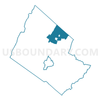
Outline

Summary
| Unique Area Identifier | 682467 |
| Name | Plains Voting District |
| County | Rockingham County |
| State | Virginia |
| Area (square miles) | 45.47 |
| Land Area (square miles) | 45.19 |
| Water Area (square miles) | 0.28 |
| % of Land Area | 99.38 |
| % of Water Area | 0.62 |
| Latitude of the Internal Point | 38.63093310 |
| Longtitude of the Internal Point | -78.79014760 |
Maps


Graphs
Select a template below for downloading or customizing gragh for Plains Voting District, Rockingham County, Virginia


Neighbors
Neighoring Voting District (by Name) Neighboring Voting District on the Map
- Broadway Voting District, Rockingham County, VA
- Edom Voting District, Rockingham County, VA
- Forestville Voting District, Shenandoah County, VA
- Fulks Run Voting District, Rockingham County, VA
- Lacey Spring Voting District, Rockingham County, VA
- Melrose Voting District, Rockingham County, VA
- New Market Voting District, Shenandoah County, VA
- Singers Glen Voting District, Rockingham County, VA
- Tenth Legion Voting District, Rockingham County, VA
- Timberville Voting District, Rockingham County, VA
Top 10 Neighboring County Subdivision (by Population) Neighboring County Subdivision on the Map
- Plains district, Rockingham County, VA (14,628)
- Linville district, Rockingham County, VA (8,114)
- District 1, Shenandoah County, VA (6,957)
Top 10 Neighboring Place (by Population) Neighboring Place on the Map
Top 10 Neighboring Unified School District (by Population) Neighboring Unified School District on the Map
Top 10 Neighboring State Legislative District Lower Chamber (by Population) Neighboring State Legislative District Lower Chamber on the Map
Top 10 Neighboring State Legislative District Upper Chamber (by Population) Neighboring State Legislative District Upper Chamber on the Map
Top 10 Neighboring 111th Congressional District (by Population) Neighboring 111th Congressional District on the Map
Top 10 Neighboring Census Tract (by Population) Neighboring Census Tract on the Map
- Census Tract 108, Rockingham County, VA (6,397)
- Census Tract 408, Shenandoah County, VA (4,721)
- Census Tract 106, Rockingham County, VA (3,651)
- Census Tract 107, Rockingham County, VA (3,318)
- Census Tract 110, Rockingham County, VA (3,034)
- Census Tract 109, Rockingham County, VA (2,581)
- Census Tract 402.01, Shenandoah County, VA (2,580)
- Census Tract 104, Rockingham County, VA (2,531)
Top 10 Neighboring 5-Digit ZIP Code Tabulation Area (by Population) Neighboring 5-Digit ZIP Code Tabulation Area on the Map
- 22815, VA (8,355)
- 22842, VA (5,063)
- 22844, VA (4,528)
- 22853, VA (4,367)
- 22830, VA (1,773)
- 22834, VA (1,250)